Satellite imagery-guided map for Turkey-Syria quake rescue work
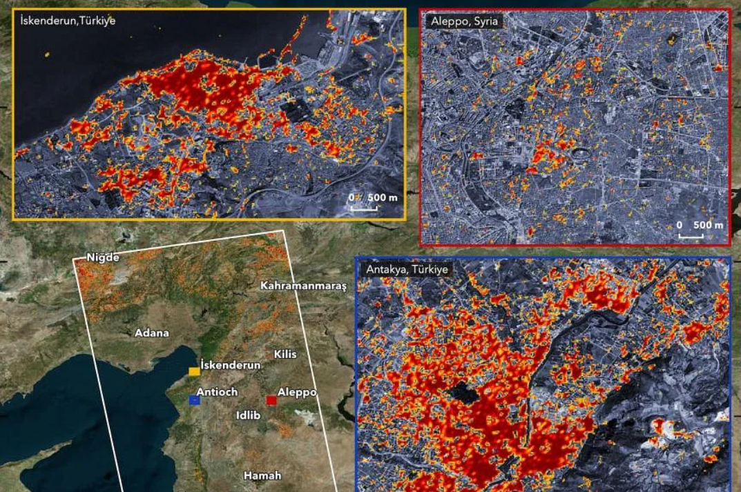
A few hours after a deadly earthquake devastated Turkey and Syria in February, a team from NTU’s Earth Observatory of Singapore (EOS) began to build maps showing the extent of the damage in the affected regions.
This damage proxy maps are processed from raw satellite data and can help to guide local governments and first responders in identifying critical areas which need rescue and aid.
Associate Professor Yun Sang-Ho, director of NTU’s EOS-Remote Sensing Lab, said they created the maps two days after the magnitude-7.8 quake and after Sentinel Asia – an initiative contributing to disaster management in the Asia Pacific – and the United Nations World Food Programme contacted them for help.
The team then collaborated with the Japan Aerospace Exploration Agency to access satellite images of the affected region before the earthquake, while the agency’s satellite captured the aftermath and worked with their partners including NASA to analyse the satellite images and to produce the damage proxy map.