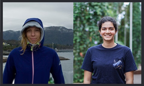
URECA Research Excellence Award to ASE student Ang Wei Jing for mapping Amazon River floodplains
 Ang Wei Jing studied the bathymetry of Amazon River floodplains.
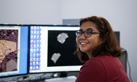
A URECA study with Assistant Professor of Physical Geography Edward Park at NIE gave ASE 3rd year geoscience student Ang Wei Jing the opportunity to look beneath the surface of the world’s largest river, the Amazon. With her project “Remote Sensing of Rivers” she won the URECA Research Excellence Award 2020/2021, and now she is publishing her results in the top journal in the field.
Large tropical rivers worldwide support livelihoods and economies, agriculture, and biodiversity, but they are also subject to intense exploitation and vulnerable to natural hazards like cyclones and flooding. However, the difficulty of accessing and navigating the largest rivers restricts the availability of field data, and the lack of data limits research and sustainability management efforts.
The goal of Ms Ang’s study was to derive the bathymetry, or ‘underwater topography’, of 12 floodplains in the middle-lower Amazon (an area with especially complex floodplain morphology) using inundation frequency, and to classify the floodplains based on geomorphology and hydrology. The results have many implications, including evaluating the role of floodplains in influencing sedimentation patterns, distribution of biodiversity and vulnerability to natural hazards like floods and droughts.

Figure 1A from the publication in Geomorphology. Inundation frequency map, used to derive the bathymetry map shown below.
ASE Comms caught up with Ang Wei Jing to find out more about her URECA experience:
What drew you to this particular URECA project?
I am interested in geomorphology, rivers and mapping, and this URECA project was a great combination of all my interests. I also wished to be able to apply what I learnt in class to research, and since I was taking modules on GIS, MATLAB and sedimentary geology, it was a good fit.
What do you think is the best part about the opportunity to do real research as an undergraduate?
I think being able to make use of the knowledge I gained in class and to explore beyond it was the best part. The research process involved much self-directed learning, where I had the opportunity to try out figure design, statistical analysis and calibrating data. It was all new to me and whenever I figured out something that I was stuck on for hours, the sense of satisfaction was very rewarding.
You characterized 12 major floodplains over a stretch of 900 km of the Amazon. It seems like a lot of work, what was the hardest part?
I think the hardest part was being able to integrate the new knowledge I obtain and applying it immediately on the research project. When I just started on the project, I was only 4 weeks into my GIS module and I had to quickly make use of what I learnt, and try to figure things out on my own.
Did your studies at ASE prepare you for the work you did during this URECA project?
Yes, my studies at ASE helped me greatly. I used ArcGIS and MATLAB a lot during the project, so the modules ES2802 and ES2001 were really useful. Writing skills I gained from ES1001 and sedimentary geology knowledge from ES2004 also helped me.
For an undergraduate student to publish a study in a top journal is quite impressive. Did you expect to publish when you took on this project?
No, I did not expect it. Professor Edward always kindly encouraged me and told me I could publish it, but I did not think that it would really happen.

Cropped version of Figure 4 from the publication in Geomorphology showing bathymetry (water depth) maps for floodplains along the middle-lower Amazon River.
Are you planning to do any more research projects in the future? Are you hooked on rivers now or looking to pursue other interests?
Yes, I will be working on a new project with Professor Edward soon. I think I would still like to work on rivers for now, but on other rivers as well, not just the Amazon. In ASE classes, we mainly work on rocks, so I enjoy learning something different through URECA research.
Which other large rivers are you interested in working on?
Professor Edward works on the Mekong River basin. The Mekong River is heavily impacted by human activities, such as dams, river-bed mining and dykes, and he researches on the effect of these activities, in terms of issues like floods, saline water intrusion and drought in the Mekong Delta.
Wei Jing would be working with Professor Edward on the Mekong River as well as the Yangtze River, to research on the water level and water extent patterns in the floodplains across different major rivers.
What are the advantages with using remote sensing? I assume you did not have to visit the field site?
Our method is based on inundation frequency (IF) data from remote sensing, and calibration with a 2004 bathymetry survey of one of the floodplains. It can be adopted based on remote sensing, and IF data is publicly available on the Global Surface Water Explorer. This overcomes the spatial limits of bathymetry surveys conducted in the field. In addition, while many other remote sensing techniques make use of water reflectance values, our approach uses binary information (water or non-water pixels). In the case of turbid water bodies, the water reflectance values would be less accurate, but our method can still be applied to these turbid water bodies as it is not dependent on the reflectance values.
Although our method can be adopted based on remote sensing, we validated our bathymetry results using field data collected across 8 floodplains in 2016 (Fig 7A_B). Wei Jing did not have to go to the Amazon, but Professor Edward did in 2016. We used the data collected in 2016 to verify the validity of our method and results.
Can your method be adopted for other rivers?
Our method of using an IF-depth model can be adopted for floodplains along other rivers, especially large anabranching monsoonal rivers. However, our model was calibrated with a bathymetry survey conducted at one of the middle-lower Amazon floodplains, so when the method is applied to other rivers, the model should best be calibrated with any available bathymetry data there.

Fig 7A_B from the publication in Geomorphology, showing the validation of bathymetry results using field data collected in 2016.
Read more:
- Original publication: Wei Jing Ang, Edward Park, Enner Alcantara (2021) Mapping floodplain bathymetry in the middle-lower Amazon River using inundation frequency and field control. Geomorphology 392: 107937
- Other ASE students who have won the URECA Research Excellence Award previous years: https://www.ntu.edu.sg/ase/news-events/news/detail/-ureca-undergraduate-research-excellence-award-2019-to-ase-students-manimaran-sonali-and-regine-tiong-hui-yi

.tmb-listing.jpg?Culture=en&sfvrsn=31c2d3fa_1)