Going back in time to save Singapore
He cracks open the tin tube that is about as long as me, then lays it out in its full glory. Sediment core, he grins. See the layers? See the roots, shells and dark organic mud? Embedded within is the history of the earth. This is the first time the Marina South core has been opened. I stare, impossibly, at this boundless container of solidified memories. Just like watching a pensieve1 coming to life.
1A pensieve, from the wizarding world of the Harry Potter series, is a stone basin that is used to collect and view memories.

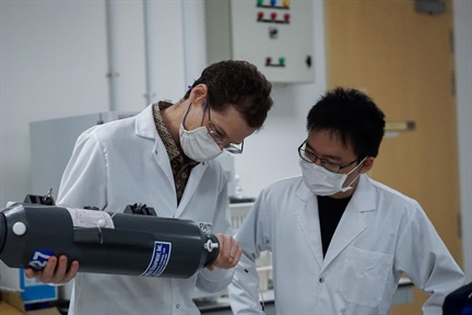
Dr. Stephen Chua (centre) holding the Marina South core. On his left is Prof. Adam Switzer and on his right Prof. Benjamin Horton. (Photo: The Straits Times)
This is all in my head, of course, but he describes the process so vividly I might as well have been there. Dr. Stephen Chua is a geologist who studies paleo-environmental reconstruction. This means he studies the past environment to predict future climatic events. By examining sediment types present in the cores, past sea levels are deduced, and past trends of sea level change are formed.

Dr. Stephen Chua storing one of the core segments in the cold room at 4℃. (Photo: Stephen Chua)
What were sea-level trends like in the past? Were they linear, or were there abrupt fluctuations? Knowing these past trends can provide insight into the science behind the complex relationship between ocean water and land-based ice. This leads to more accurate predictions of local impacts caused by today’s sea level rise.
Consequently, better predictions also lead to more strategic adaptation and mitigation responses to sea-level change. For example, a focus on purely hard engineering infrastructure (or conversely, purely natural-based solutions) may not be as wise as compared to a mixed or hybridised solution that includes the two. The thresholds of mangrove survival stands at approximately 6–7mm of sea level rise therefore informs on the most appropriate measure (Saintilan et al., 2020).
An experienced scientist who has been working in environmental science for the length of my lifetime (20 years!), Dr. Chua, now in his forties, first began working at Sungei Buloh in the early 2000s with 5000–6000 year old mangrove peats. Later, in the late 2000s, he moved to working on understanding coastal erosion and morphology of mangrove areas at Pasir Ris.
Furthermore, given the relative scarcity of historical sea level records in Singapore and Southeast Asia, these projects fulfill a critical gap. Reasons for such limited data abound: publications done in local or regional journals may be hidden in an obscure library or small journal, or perhaps publications may be done in local languages that are less easily understood.
Perhaps Dr. Chua learnt about sea level rise the hard way, too. Once, during low tides at Sungei Buloh, he was mapping mudflats when he suddenly realised: he was sinking in it!

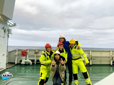
Dr. Stephen Chua (left) and then-Honours supervisor Prof. Michael Bird (right) coring at Sungei Buloh. (Photo: Stephen Chua)
Another challenge Dr. Chua faces in his work is finding the right location to take samples. Poring through lots of geological maps and data, one can still never be completely certain that the location is the right place, and nor is there any guarantee that after the core is taken, one will achieve what one had envisioned. Getting the wrong location can be a costly mistake, particularly when the location for the sample is on restricted areas (which has unfortunately happened before).
Partnering with other overseas universities in the region is also another way of dealing with insufficient location data in Southeast Asia. This entails the sharing of knowledge and expertise between the universities, such as teaching people how to take samples and do analyses.
But gathering all this knowledge is pointless without implementation. Dr. Chua hopes that the engineering and scientific communities can be more integrated, rather than the present norm of separating such respective projects and finances. “It would be great if the engineers (who study scientific applications) and the academics (who study fundamental science) work on the same question”, he says. “Although the gap is getting smaller: engineers should work closely with geoscientists to better understand the environment to achieve societal goals, for example in Environmental Impact Assessments (EIAs).”
“When I first came to EOS, I had thought that sea level was level,” reflects Dr. Chua. “Now I know that the sea level is uneven throughout the world, and that Singapore is affected by local effects such as subsidence… The more you learn, the more you realise you don’t know.”
As I listen to Dr. Chua speak, I wonder how much of the past we still don’t know and how much of the future we will ever be able to know. Will one ever get tired of searching?
But curiosity propels Dr. Chua to keep pondering; to keep weaving the past, present and future together. “I have a feeling the amount of work needed far exceeds my working life”, he says genially. So he continues.
.tmb-listing.jpg?Culture=en&sfvrsn=f3ea25b7_1)