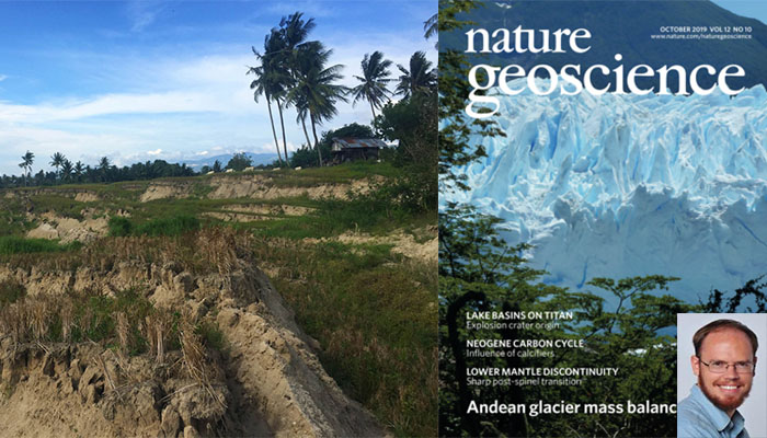
ASE/EOS researches reveal reason behind unexpected landslides following last year’s earthquake in Palu, Indonesia

A recent publication in Nature Geoscience led by ASE/EOS Dr Kyle Bradley tracks down the unexpected reason for devastating landslides triggered by the 2018 Palu earthquake. ASE/EOS co-authors of the study are Mr Rishav Mallick, undergraduate student and C.N. Yang Scholar Nairong Du, Asst Prof Judith Hubbard, Assoc Prof Adam Switzer, Dr Jedrzej Majewski, Asst Prof Shengji Wei, and Assoc Prof Emma M. Hill. The work was conducted in partnership with researchers from the Tsunami Disaster Mitigation and Response Center at Syiah Kuala University, Banda Aceh, Indonesia, and other international universities.
A year ago a devastating earthquake struck Palu, Indonesia, resulting in a tsunami rapidly inundating Palu City, which was widely depicted in the media. However, it soon became clear that the earthquake also triggered devastating landslides on the gentle agricultural slopes of the Palu Valley, with thousands of casualties. Though landslides are commonly triggered by earthquakes, the location of this one was surprising to geologists. Since the slope was not very steep and liquefaction was unlikely with relatively large distance to river channels and the ocean, it was not considered an area with any major risk of landslides.
The ASE/EOS researchers noted that the landslides occurred on a slope, but had features that indicated lateral spreading of sediment, as if they had been caused by liquefaction, which usually happens in flat areas. In search for the cause of the landslide, the researchers studied satellite images of the area from before and after the Palu earthquake. They realized that an aqueduct used for irrigation and wet rice cultivation in the area was affecting the water table. Water had been drawn from or slowly leached from the aqueduct resulting in a raised water table, meaning that the ground was saturated with water to a higher level than what naturally occurs in the area. When the earthquake struck, and the earth was shaken, the sediments would normally have compacted a small amount without any observable surface effects. However, saturation with water prevented compaction and promoted liquefaction in the subsurface, resulting in the devastating landslides. They also noticed that areas of mixed agriculture, where heavily irrigated fields were interspersed with stands of trees like coconut palm, showed more resistance to landsliding, likely due to a lower water table. This observation could potentially motivate future crop management schemes that take the hazard of a high water table into account.
Dr Bradley and co-authors point out that The Palu Valley is not the only place where irrigation has artificially raised the water table, and it is a risk factor that should be taken into account in areas with active faults, where an eventual earthquake may be expected.
Read more about this story in this EOS Blogpost: Why the 2018 Palu Landslides Were So Deadly
Watch a video on the story by EOS here
Find the original article here: Earthquake-triggered 2018 Palu Valley landslides enabled by wet rice cultivation

