
Tier 3 to ASE/EOS Prof Horton and collaborators for the Southeast Asia SEA-level Program – towards home-grown expertise on sea level science and policy in Singapore and Southeast Asia
The SouthEast Asia SEA-levelprogram sets out to produce world class interdisciplinary sea-level sciencefocused on Southeast Asia and framed to promote resilient coastal cities andcommunities in Singapore and the surrounding region.
The program, known as SEA2, is led by Prof Benjamin Horton (EOS/ASE) with Assoc Profs Emma Hill andProf Adam Switzer and Asst Profs Aron Meltzner and Asst Prof David Lallemant playingimportant leading roles. The multi-disciplinary team includes experts fromASE/EOS includes Assoc Prof Xianfeng Wang and Asst Prof Perrine Hamel and arange of other collaborators from NTU, NUS and elsewhere. An important goal ofthe program is to train a home-grown scientific community that can respond toSingapore and Southeast Asia’s need for future sea-level projections and theirinterpretation, that is both the scientific basis and its translation intopolicy.
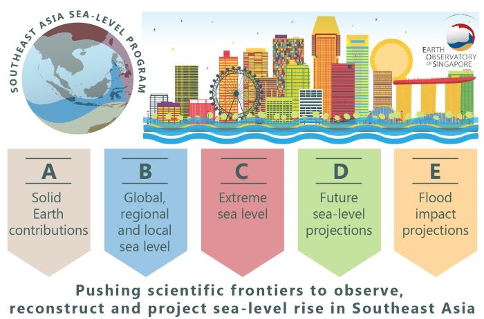
Tier 3 is the largest of NRF’s Academic Research Funds,supporting high-impact, multidisciplinary research programs over five years.SEA2 addresses the issue of rising sea levels, a global phenomenonresulting from climate change, that is making coastal cities and infrastructurevulnerable to flooding, coastal erosion, salinization of surface and groundwaters, and degradation of coastal habitats. But the process of sea-level riseis not uniform, in fact it can vary significantly between places depending onvarious factors including ocean and atmospheric circulation patterns,gravitational and deformational effects of land ice mass changes (like meltingpolar ice sheets), and tectonic (vertical) movements. This is why it is key tohave a regional sea-level program for predicting the impact of sea-level risein Southeast Asia, rather than relying on data from Europe and North America.
This comprehensive program will cover rates, mechanisms,and geographic variability of sea-level change. Improved accuracy of futureprojections of sea level rise and extreme sea level will come fromsophisticated modeling of instrumental, historical, and geological sea-leveldatasets in Southeast Asia. The future projections will be extremely robustthanks to the added consideration of vertical land movements combining space geodesy and numerical models. This will capture landmotions caused by anything from draining of peatland and groundwater extractionto earthquakes and glacial cycles.
Historical records of sea-level fluctuations will beextended beyond what is currently known using various geological proxies suchas cave deposits or coral microatolls. These records will help understanddynamics of sea level fluctuation in response to climatic changes that may bespecific to Southeast Asia. The extent of extreme sea levels produced by stormsurges or tsunamis is a crucial part of future sea-level predictions and willbe modeled based on historical and tide gauge data.
Ultimately, all the science described above, and more, willbe used to quantify and forecast the potential impact of future sea-level riseon coastal communities in Southeast Asia, based on simulations of localvulnerability in different scenarios, where the role of natural infrastructurefor flood-risk reduction and other long-term adaptations will be considered.